
Last August, a group of us attempted a 4-day backpacking trip on the Skyline Trail ( previous post ) in Jasper National Park. Between huge blisters on my feet and snow when we woke up on the 3rd morning we had to abandon the second half of the trail. In mid-July this summer a small group of us returned to complete the trail.
(As with all my posts, click on any photo to see a larger version).
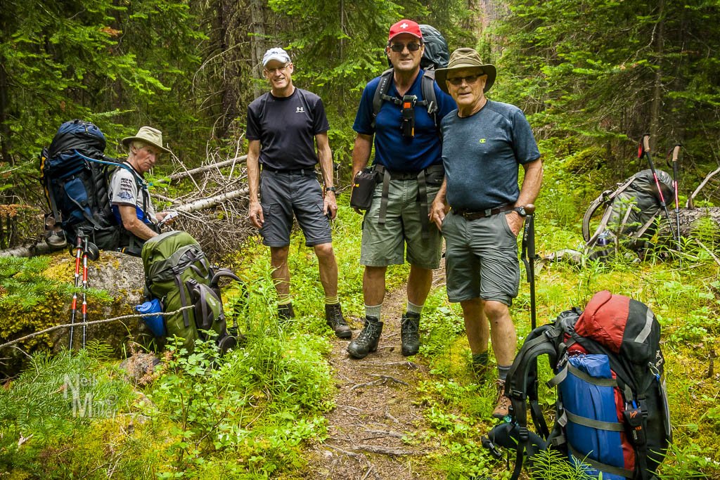
Our plan was to hike up the Watchtower Trail to rejoin the Skyline Trail near the part where we had left off last summer. With one vehicle parked at where we would ultimately exit our hike, and the other at the trail-head, we started our climb to the Watchtower Campground, some 10 km away. The trail was mainly uphill and quite overgrown in areas. We made our way through sections that had burned in a forest fire a little over a year ago. While the green underbrush was starting to regenerate the obvious signs of the fire remained.


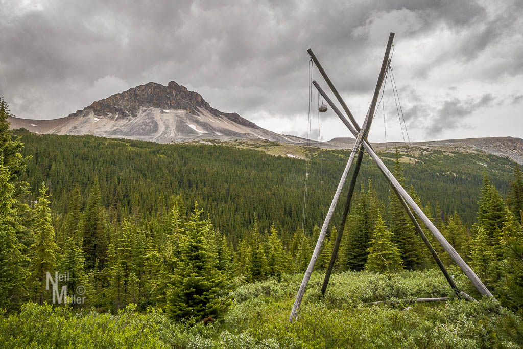
While it was cloudy, it didn’t rain during the first day of hiking. However, recent rains meant that for a lot of the day we were slogging along muddy trails and hopping on rocks across little streams. For much of the day we followed Watchtower Creek with a crossing of the creek required at the end of the day to get to the campground. Hordes of mosquitoes greeted us upon arrival. The tent sites themselves were mounded making it very difficult to find a flat place to pitch your tent. In any event we pitched our tents and enjoyed our respective freeze-dried dinners. Just as we were finishing dinner, the rain started. One of our group had earlier put up a tarp which made a great place to get out of the rain for a while. Even though it was still early, during a break between showers we headed up to the tents and retired for the evening. I had no problem falling asleep!


The rain continued through much of the night but quit early in the morning. Even though the fly was still wet, we were able to pack up the tent and the rest of the gear without getting everything else wet.
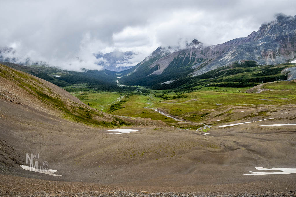
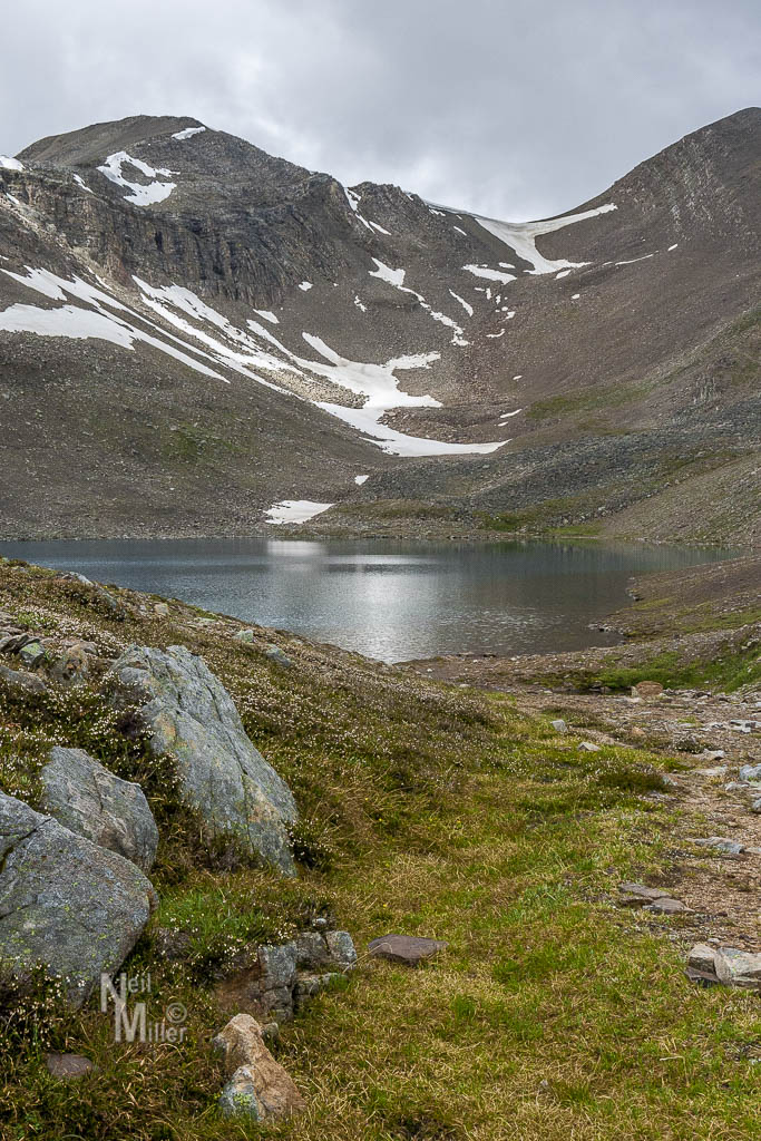
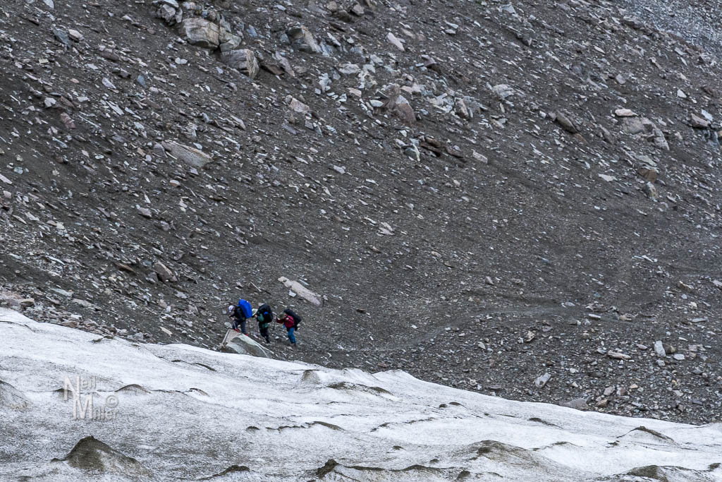
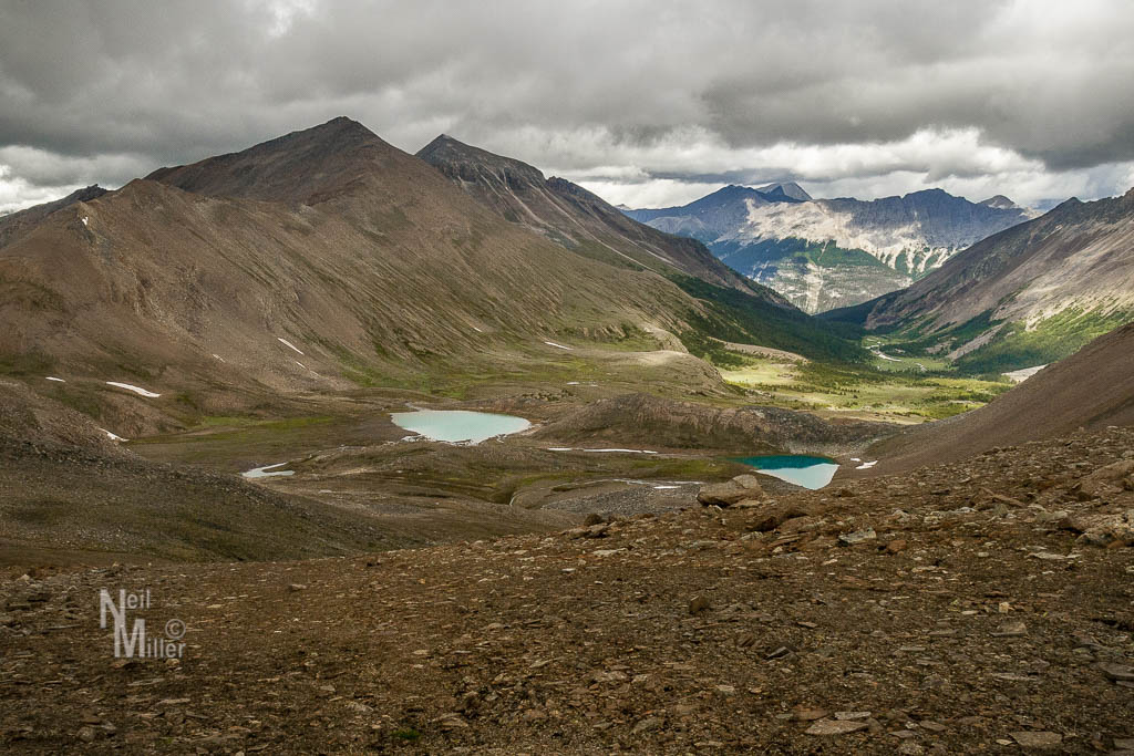
The day started by continuing up the Watchtower Trail to where it joined the Skyline Trail. This 3.4 km section included a pretty steep climb through shale skree which required some careful footing. By mid-morning we were on the Skyline Trail, heading to Curator Lake where we stopped for lunch. As we relaxed and had something to eat, we had a nice view of the lake and the trail up to The Notch.


Even though the trail to The Notch was only 2 km it was fairly steep in parts which made for a challenging climb. The last little bit was an uphill climb through a patch of snow. At the top we were greeted with a cold wind and tiny hail pellets. As soon as all of our group was at the top we headed off in hopes of getting out of the wind. While the wind did decrease a bit the clouds rolled in and a light rain started. With the start of the rain my camera got wrapped in plastic and buried in my pack to keep it dry, pretty much ending further photography.

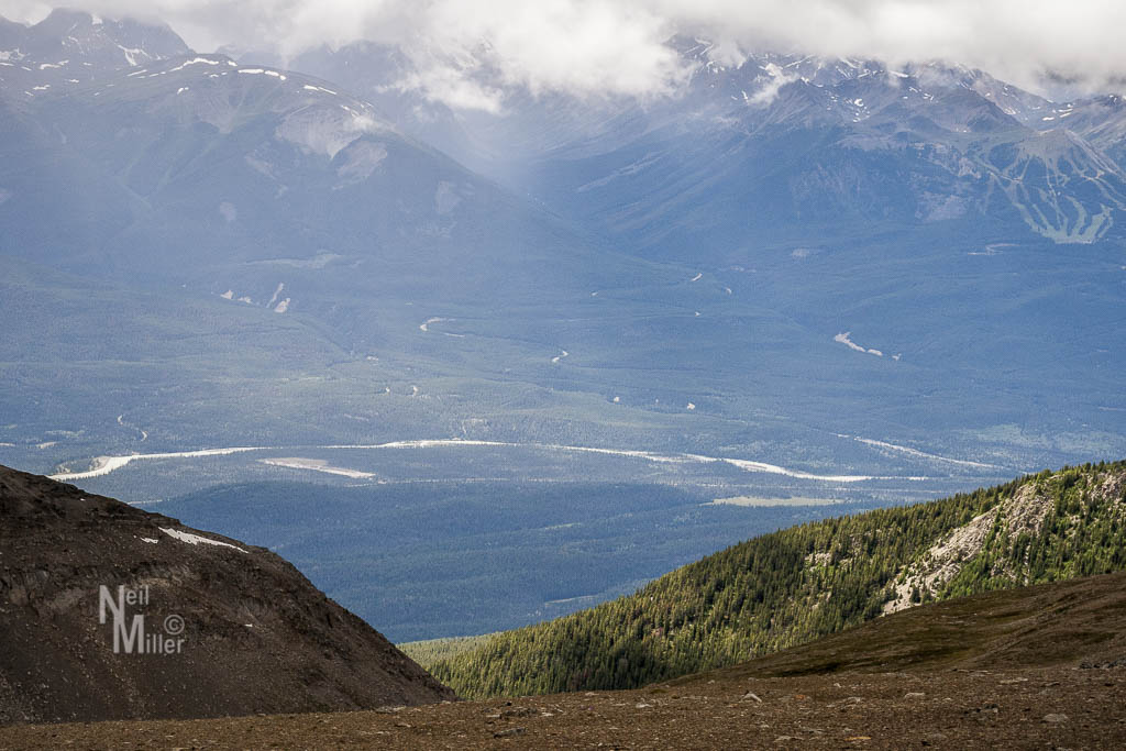
Our route took us along a ridge for several more kilometers before finally starting to descend towards Tekarra Campground. As we got down to the valley floor we had a brief encounter with a grizzly. I first saw the bear up ahead, crossing a stream. It angled off away from us, disappearing behind a ridge. By now we had our bear spray and bear bangers out and were watching for the bear to reappear. After a minute or so it popped up on the ridge about a 30 or 40 meters from us. I yelled and waived my hiking poles in the air and it turned and ambled away from us. We continued to watch the bear for several minutes to make sure it didn’t circle back, then continued our hike.
The light rain let up shortly before arriving at Tekarra Campground in late afternoon. Our total distance for the day was about 16 km. The campground itself was pretty much a mud bog. Our tent site looked like it had been partially washed away in spring runoff. What was left was sloped so again the tent had to be positioned so that our heads would be uphill. Some of the other tent sites were in slightly better condition but still mounded rather than flat.
I have to interject at this point that Parks Canada should be totally embarrassed by both campgrounds we stayed in on this hike. They were poorly maintained and the tent pads were atrocious. Hikers from all over the world pay for the “priviledge” of staying at these campgrounds. Yes, they are back country camping and one shouldn’t expect first class facilities. However, when you are paying for the site it would be nice to at least have a decent tent pad. In the overall scheme of things, the cost to build flat pads surrounded by 4X4’s for the 6 or 8 sites at each campground would be minimal and would be greatly appreciated by the backpackers who are paying good money for them.
Once again, the mosquitoes at Tekarra drove us into our tents early. The rain started a short time later and again continued through the night. While it let up briefly in the wee hours of the morning, we packed up in the morning in light rain. With this being our final day it wasn’t as big an issue as we wouldn’t be having to set up wet gear later in the day.
Our hike took us another 5 km along the Skyline Trail, much of it uphill, before starting a 9 km descent down the Signal Mountain Fire Road. With a 45 pound pack on your back, 9 km of steady downhill is pretty tough on the knees and feet. I was pretty happy to reach the parking lot at the end of the trail by shortly after noon.
Even though cloud and rain on our hike had obscured some of the great scenery, it was still a pretty enjoyable 3 days (although I certainly wouldn’t have complained about sunny skies!).

Leave a comment