

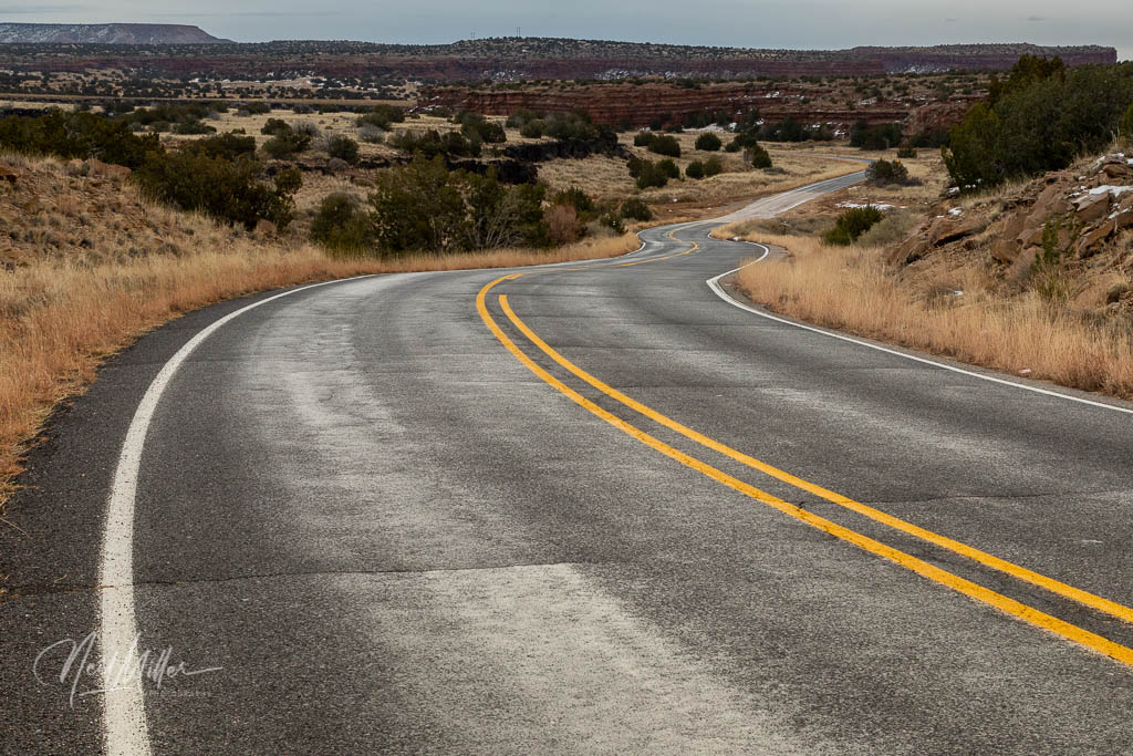
As I wait out my 14 days of self-isolation following my return to Canada from the US, I have an ideal opportunity to continue the tale of my Route 66 journey last December.
Just after leaving Albuquerque, NM one comes to the Rio Puerco Bridge. Built in 1933, it was designed to withstand the regular flooding of the river for which it is named. At 250 feet long, when it was built it was the longest bridge of its kind in New Mexico.

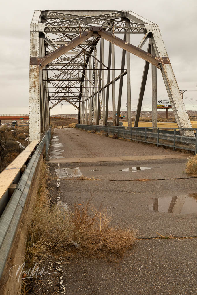
Rio Puerco Bridge
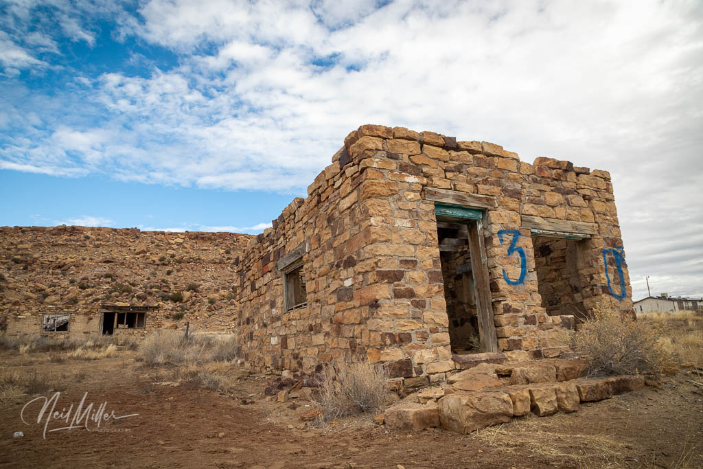
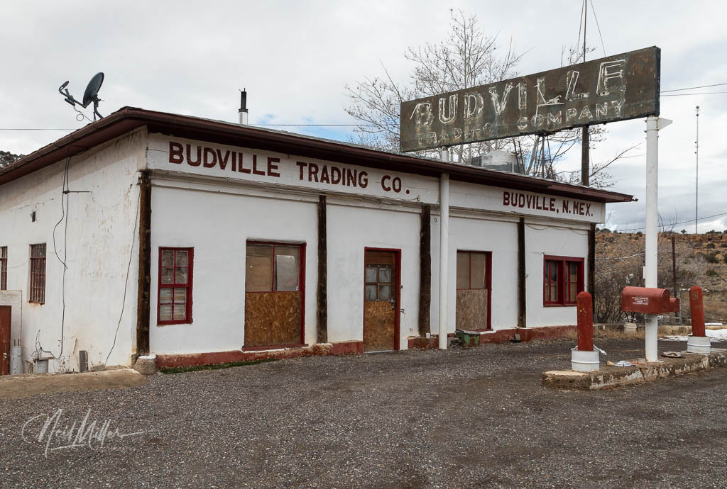
Back on the road I came upon some ruins of several old stone Native buildings before arriving at Budville, named after H. N. “Bud” Rice. Starting in 1928, Bud and Flossie Rice operated the Budville Gas Station, a combination service station and trading post. It was the only car repair garage between Albuquerque and Grants. In 1967, during a robbery of the station, Bud Rice was murdered. Flossie continued to run the business until 1979. Since then there were several attempts to resurrect and run the trading post but none proved successful and the property now sits vacant.

From Budville, Route 66 continues on to San Fidel. The San Fidel Trading Post was closed, although I’m not sure if it was seasonally or permanently. Another building in town is the now-abandoned Acoma Curio Shop which is on the National Register of Historic Places. Built by Lebanese immigrant Abdoo Fidel in 1916, it originally operated as a general store. When Route 66 came through town, Fidel started selling Native American Crafts and renamed his business the Acoma Curio Shop. Unlike most businesses along Route 66 selling Native American crafts, he only sold that which was made in the area.

San Fidel Trading Post 

Acoma Curio Shop 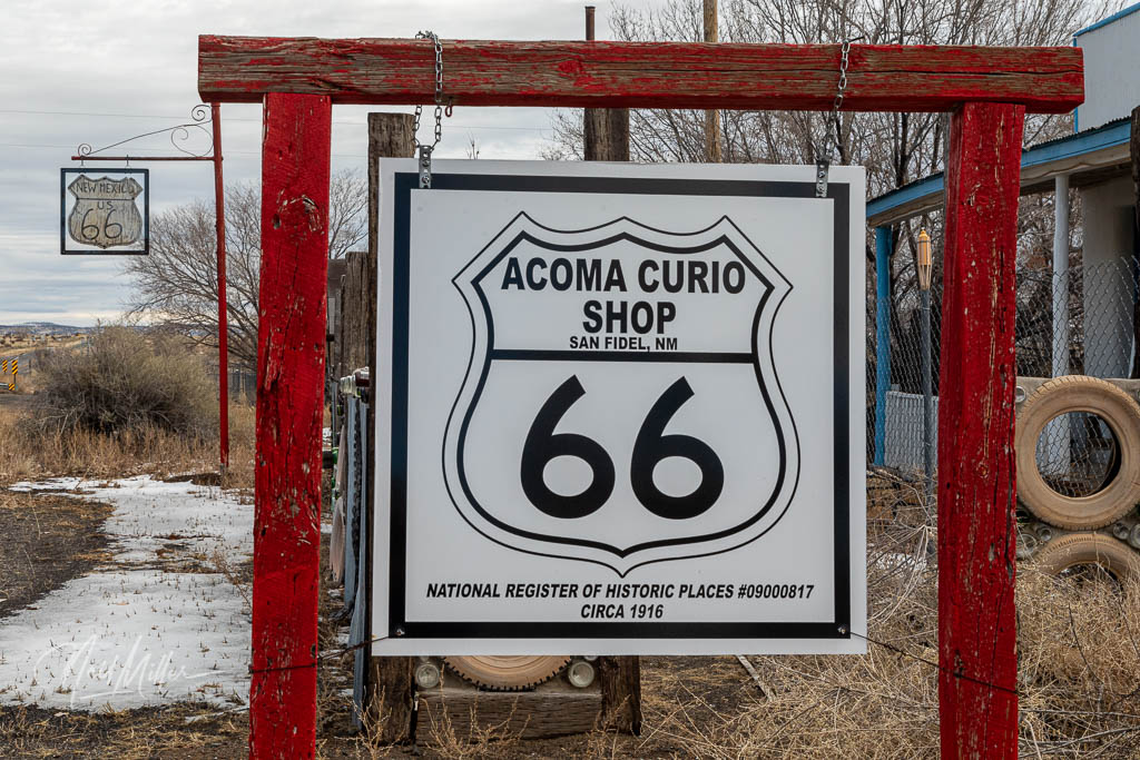
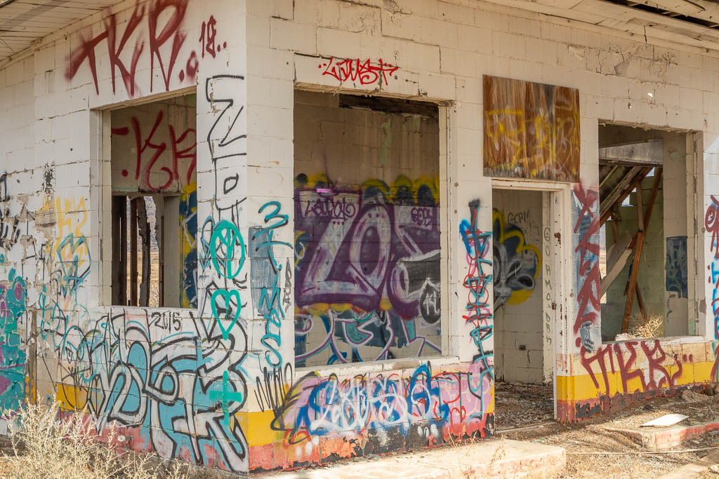
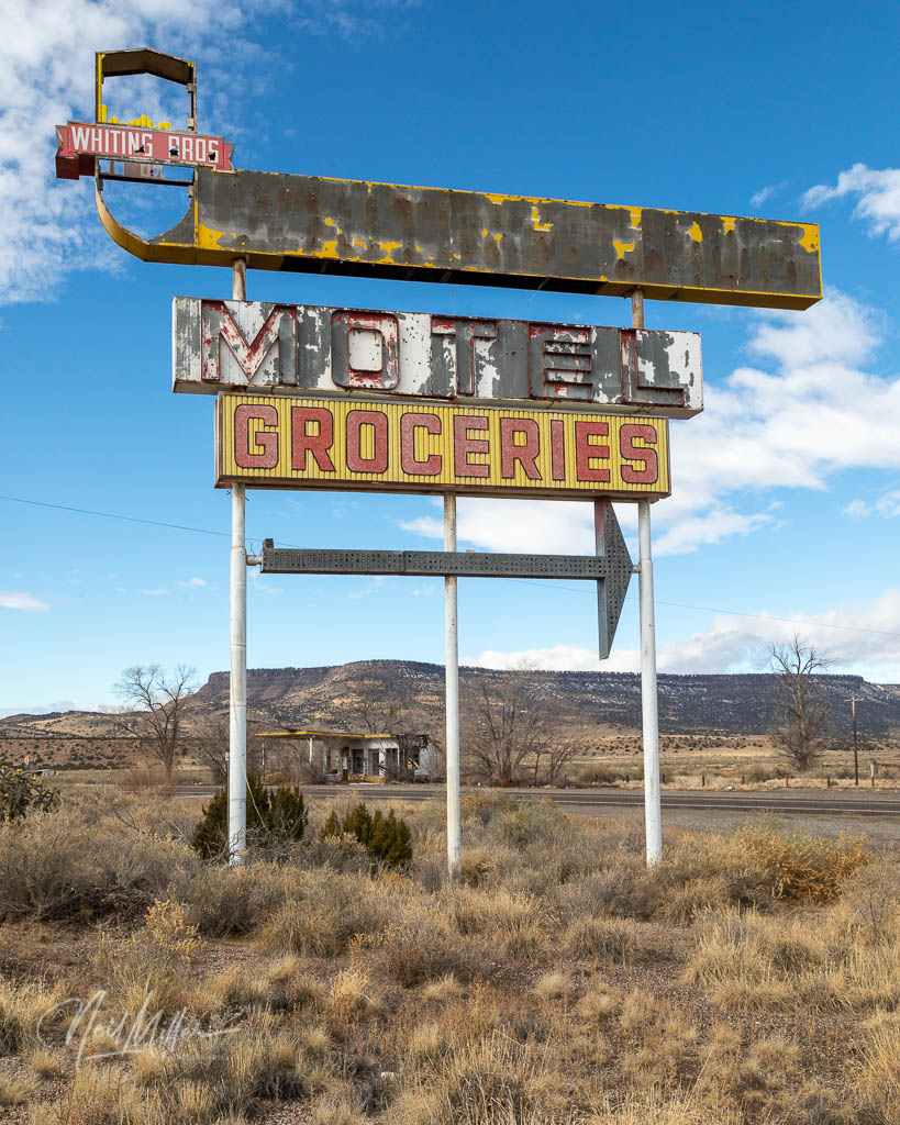
A little further down the road, between San Fidel and McCartys, is the old, abandoned Whiting Brothers Gas Station which once included a motel. Only the partially burnt out gas station, liberally decorated with graffiti, is left: the motel apparently disappeared years ago.

On the hillside overlooking McCartys is an impressive looking stone church. Santa Maria de Acoma Church was built in 1933.

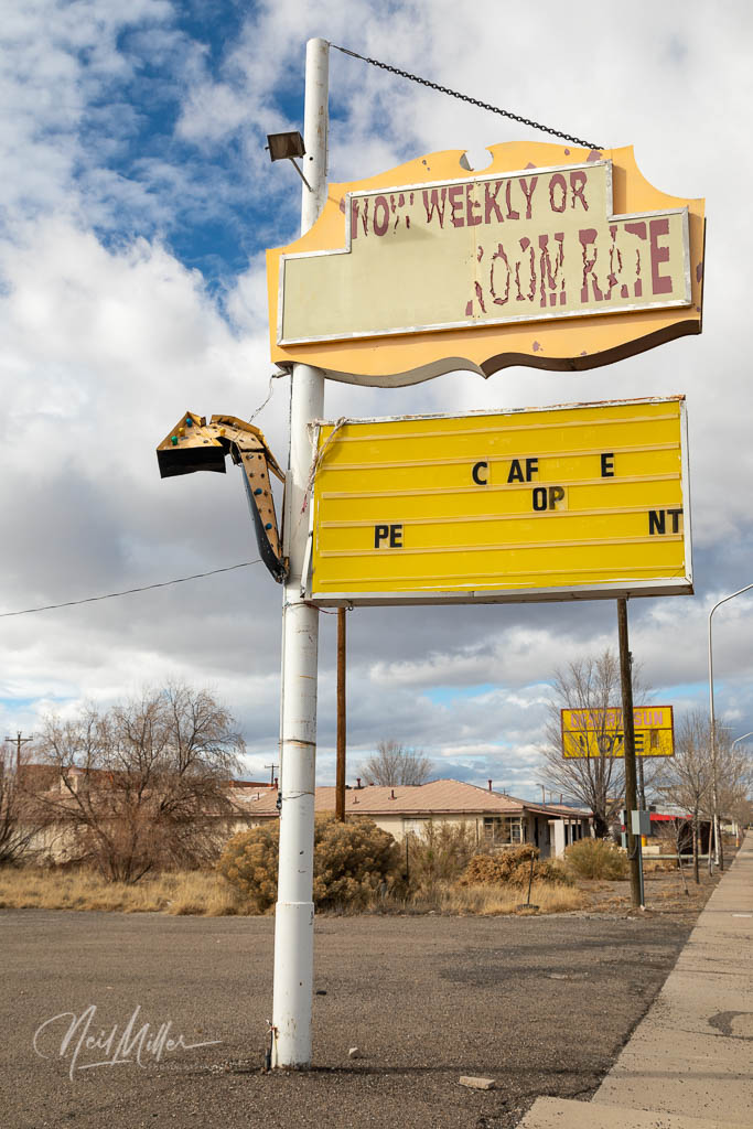
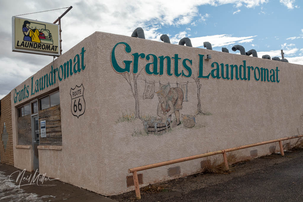
The drive into Grants passes by a number of old, abandoned Route 66 motels and other businesses. Interestingly, the City of Grants originated as a railway camp set up by three Canadian brothers; Angus, John and Lewis Grant. The brothers had been awarded a contract to build a section of the A&P Railway. Eventually this railway town grew into a successful farming community. In 1950, a Navajo rancher discovered what was to become one of the world’s largest uranium reserves in the hills about 10 miles from town. The resulting mining boom lasted until 1983 when recession closed the mines.
Like many towns along Route 66, the decommissioning of the Mother Road, no doubt coupled with the end of the mining boom, had an impact on the Grants. However, tourism seems to be driving an economic growth in the city. And like a good tourist, I decided to find a spot for lunch. I have to say that El Cafecito had the best Chilli Rellenos I have had in quite some time!


Further west, in Thoreau, a small cafe, Johnny’s Inn, was move from north of the tracks to sit alongside Route 66 sometime around 1947. Subsequently it was added on to and became the Red Mountain Market & Deli. The original building can be seen on the left hand side. It is the section with the single door and two windows. A faded Johnny’s Inn sign can be seen above the door.
After the 1937 realignment of Route 66, a Standard Oil operated gas station was moved from Grants west to the town of Thoreau. In 1950 Roy Herman bought the station and operated it with his sons. The old station, with its 3 white enamel gas pumps, sits in front of the current repair garage.

Red Mountain Market & Deli – original Johnny’s Inn is the section with single door and window on each side. 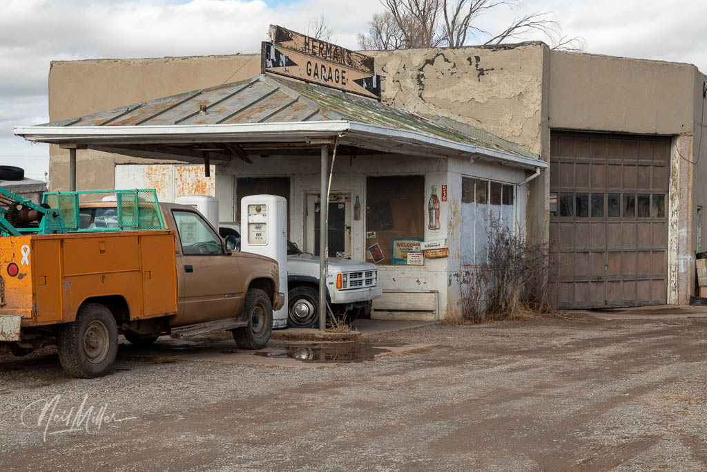
Herman’s Garage with the three white enamel gas pumps in front.
5 miles west of Thoreau is the Continental Divide, the highest point on Route 66. At one time, there were many Native American markets. A few still remain, with one being located near the Continental Divide.


One regret that I had on this trip was that I didn’t have enough time to explore some of the larger centers along the route. Gallup is certainly a town I would have liked to spend more time in to check out the Rex Museum and the El Morro Theater to name a couple of sites.
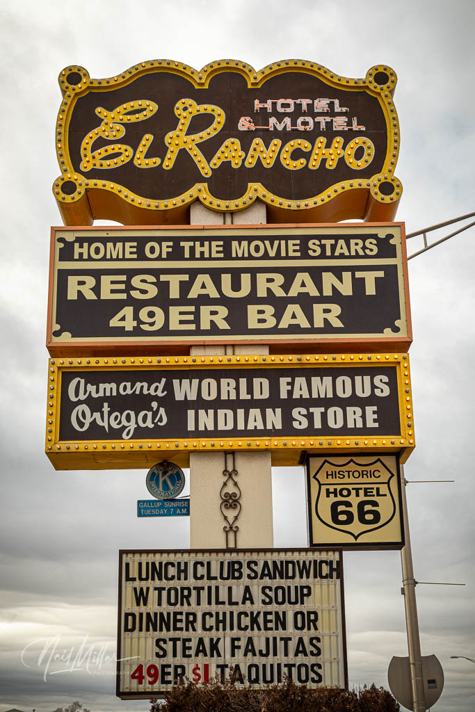
The Hotel El Rancho opened in the 1930’s and in its day was a premier hotel in the area. Movie stars such as Katherine Hepburn, Humphrey Bogart, John Wayne, and Mae West stayed here while filming in the area. With the decommissioning of Route 66 and the declining interest in the old west, by the mid-60’s the hotel had declined substantially. Fortunately the property was purchased by Armand Ortega and restored to its early glory. Perhaps one day I will have a chance to return to explore Gallup more fully and stay at the Hotel El Rancho!

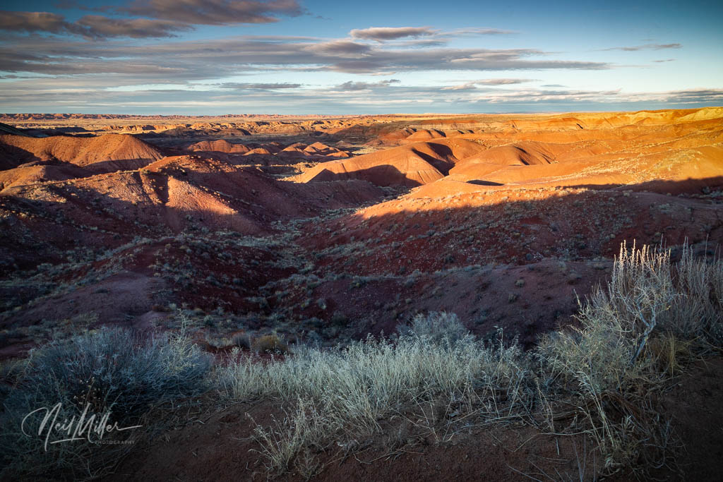
Crossing the border west of Gallup, you soon come to the Painted Desert. I made only a quick trip a short way into the National Park as I had driven through the park on a previous trip to the area. It was getting late in the day so I had a chance to at least capture a bit of color.
A short distance from The Pained Desert is Holbrook, home of one of the three remaining Wig Wam motels. Readers of my blog will recall that I spent a night in the Wigwam Motel in San Bernardino … link to earlier post


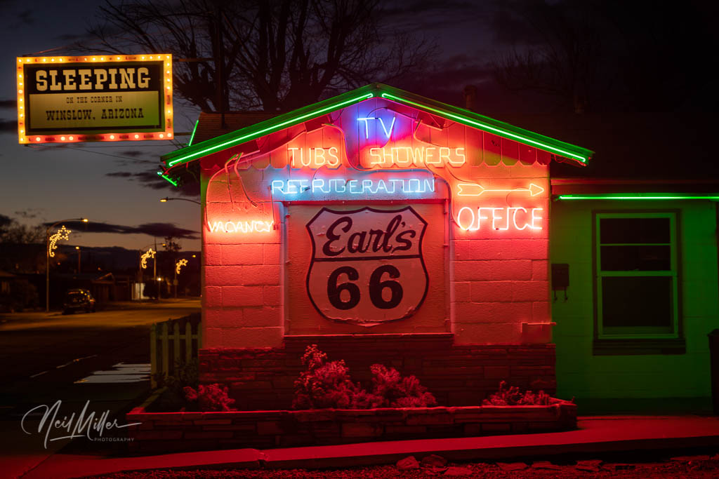
By the time I rolled into Winslow, AZ it was getting dark. I checked out a few neon signs then checked into La Posada Hotel for the night. And this is where I shall pick up my tale in my next post.

Leave a comment